Christchurch 360 Trail: A work in progress
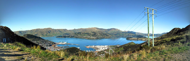
Section walking the Christchurch 360 Trail One of the outdoor side projects I am working towards is the of the Christchurch 360 Trail . Panoramic view of Lyttleton Harbour from the Summit Walkway The Christchurch 360 Trail is a long distance trail joining existing tracks, park walkways and reserves around the perimeter of the city of Christchurch. The total length is 135 km's and the trail can be covered by any form of transport including walking, running, riding and on horse. Official map of the Christchurch 360 Trail The trail encompasses both off road tracks and urban areas so it is a mix of bush, forest, reserve and road. A long section of the trail follows the Crater Rim Walkway along the Port Hills and another the river embankments from near Brooklands right out to McLean Island. Map Legend for Christchurch 360 map As you can see on the map below I have completed a fair chunk of the trail, the pieces missing are interconnecting sections of roa...