Section walking the Christchurch 360 Trail
 |
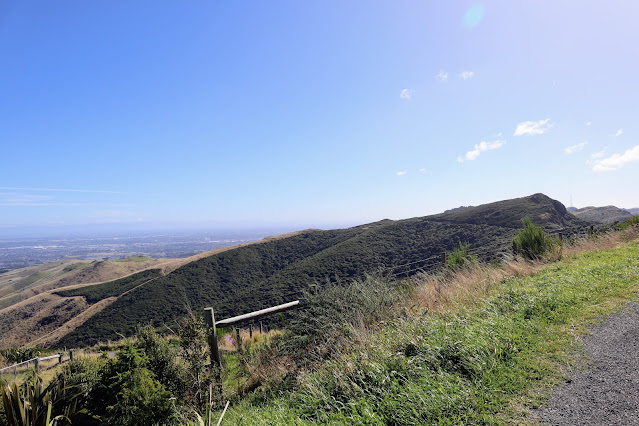
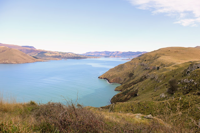
| Panoramic view of Lyttleton Harbour from the Summit Walkway |
The Christchurch 360 Trail is a long distance trail joining existing tracks, park walkways and reserves around the perimeter of the city of Christchurch. The total length is 135 km's and the trail can be covered by any form of transport including walking, running, riding and on horse.
|
Official map of the Christchurch 360 Trail |
The trail encompasses both off road tracks and urban areas so it is a mix of bush, forest, reserve and road. A long section of the trail follows the Crater Rim Walkway along the Port Hills and another the river embankments from near Brooklands right out to McLean Island.
|
Map Legend for Christchurch 360 map |
As you can see on the map below I have completed a fair chunk of the trail, the pieces missing are interconnecting sections of road biking for the most part. I am going to make a concerted effort to complete the trail before the end of the Summer and will post when I have finished the remaining sections.
|
Sections of Christchurch 360 Trail completed as of January 2016 |
Here are some photos from completed sections of the trail
Sugarloaf Hills Section: Completed in 2016
This section starts at Halswell and ends at Evans Pass road. I've done numerous walks along Port Hill tracks over the years, and also mountain biked most of them at one time or another. This is one of my fully completed sections of the trail.
I've walked up Kennedys Bush Track four times and MTB'd up here at least 10 times...it used to be one of my MTB haunts back in the early 90's.
 |
| Near the start of Kennedy Bush Track on Kennedy Bush Spur |
 |
| Mid way to the Summit Road, Kennedy s Bush Track |
Below is the track finish/start up on the Summit Road, you follow the road from here around to the Sign of the Kiwi
 |
| Kennedys Bush Track, top of the track on the Summit Road |
Kennedy's Bush Track is now rejuvenating after the monster wild fire we had on the Port Hills early in 2017. Most of the forest and scrub alongside the track is now gone...burnt by the fire, it is slowly being replanted.
 |
| The Port Hills wild fire, in early 2017 from the Cashmere Hills |
The following are photos taken from the Sign of the Kiwi to Mt Pleasant Road.
 |
| Summit Walkway Sign part of the Christchurch 360 Trail |
 |
| Governors Bay from near the Sugarloaf, Christchurch 360 Trail |
 |
| TV transmitter, Sugarloaf looking South |
The trail follows the Crater rim Walkway all the way from the Sign of the Kiwi right out to Godley Heads at the mouth of Lyttelton Harbor. This is a long established trail set up by the pioneer environmentalist Harry Ell in the early 1900's.
 |
| Jon at the head of the Bridle Path |
 |
| Bridle Path Sign, Heathcote Valley, Christchurch 360 Trail |
 |
| Christchurch 360 Trail: Gondola terminus on Mt Cavendish |
 |
| Lyttleton Harbour from near Mt Evans part of the Christchurch 360 Trail |
 |
| Christchurch 360 Trail, rest spot on way to Mt Pleasant |
 |
| DOC track sign on Crater Rim Walkway, Christchurch 360 Trail |
 |
| View to Pegasus Bay from Summit Road below Mt Pleasant |
Godley Cliffs: Completed in 2019-2020
I have mountain biked the section of Summit Road from Evans Pass to Godley Heads many times. Godley Heads is home to a series of World War II defence fortifications...there was a gun battery, MG posts and barracks here for the defence of Littleton Harbour. You should go have a look it is fascinating stuff...
 |
| The road from Evans Pass to Godley Heads |
Just as an aside...the only time they were ever allowed to shoot off the big 8 Inch gun they accidentally sank a local fishing trawler...they did not actually aim at it! Dead eye dicks all the way!
Just as well the Imperial Japanese Navy never came calling...
 |
| DOC sign explaining the Godley Heads gun emplacements |
 |
| One of the gun casements at Godley Heads |
The official track follows the course of the Crater Rim Walkway but I'm going to call that a finished part of this section. I still need to walk the rest of the section from Taylors Mistake to Sumner. this is the only section of the trail I have never covered.
 |
| Looking down towards Taylor's Mistake from near Godley Heads |
NB: There is a
DOC campsite at Godley Heads, it is open over the summer months, make a booking before you go.
Estuary/Marshes: Completed in 2019
Dunes/Wetlands: Completed in 2018
I've walked from Waimairi Beach to the Adrenaline forest at Spencer Park, the walk up the
Southern Pegasus Walkway is one of the tracks I use when fitness walking. I completed the Wetlands section
 |
| Crossroads at start of Bottle Lake Plantation, Christchurch 360 Trail |
 |
| Christchurch 360 marker near Waimairi Beach |
 |
| Christchurch 360 Trail: the track near the old Burwood landfill |
 |
| Southern Pegasus Walkway, MTB/walking track |
 |
| Lunch stop on the PegasusWalkway, Christchurch 360 Trail |
 |
| Entering Spencer Park on the Christchurch 360 Trail |
 |
| Spencer Park surf lifesaving rooms, turn left here |
 |
| Christchurch 360 route heading to Adrenaline forest |
Brooklands Mouth
This section is best ridden on a bike. I have yet to complete this section although I have ridden my bike between Spencer Park and Brooklands before.
Waimakariri Braids
Another fully completed section, this used to be my haunt back in my MTB crazed days, I have ridden almost all of the tracks and gravel roads from the Waimakiriri Bridges to MacLeans Island.
I go "off piste" at the end as I used to do a road cycling circuit from my flat in Avonhead, around the Airport, past MacLeans Island and back down West Coast Road. This is slightly off the official route (its actually longer by 5-7 km's than the official trail), but again I'm going to call it completed .
 |
| Start of the MTB track at McLeans Island |
 |
| Travelling through McLeans Island forestry block |
 |
| Rain swollen Waimakiriri River from the Christchurch 360 Trail |
Avonhead Gardens
I used to have a bike circuit out behind the airport which took in Mcleans Island Road, Orana Wildlife Park and the Old West Coast Road. I would bike round there 2-3 times a week. I've also walked the section from Deans Bush to the University, but still need to complete the other parts of this section.
 |
| Walking through Riccarton (Deans) Bush |
Riccarton Bush is a remnant of the Kahikatea forest that once clothed much of the Canterbury Plains. If you are walking this section do so on a Saturday so you can check out the Farmers Market they hold at Riccarton House each Saturday. Real good eats.....
 |
| Riccarton Farmers Market, Riccarton House |
Opawaho Divide
I live out near Hilmorton and have walked all sections of this part of the Trail. This section takes in the suburbs of Aidenfield and Hallswell and the Christchurch Agricultural Park near Wigram.


Comments
Post a Comment